
Basin Lining Requirements Over the Recharge Zone
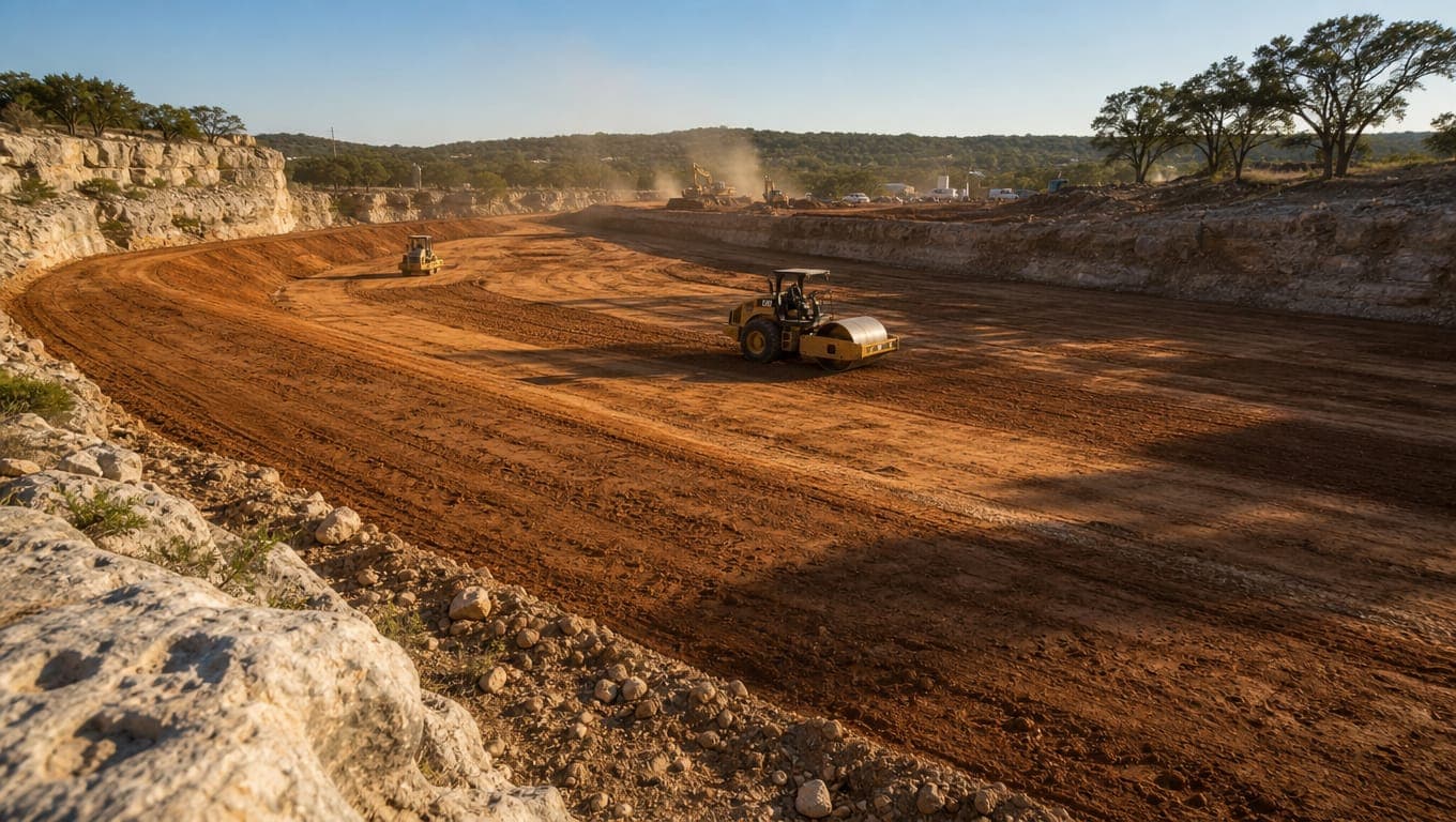
Water quality basins over the Edwards Aquifer Recharge Zone require impermeable liners. TCEQ's technical guidance, RG-348, allows clay, concrete, or geomembrane. A clay liner needs a minimum thickness of 12 inches and a permeability of 1 x 10⁻⁶ cm/sec. A geomembrane needs a minimum thickness of 30
Published October 5, 2026. Last reviewed October 5, 2026. Technical review: Jim Price, CISEC, CESSWI. Founder, Stormwater Compliant LLC.
Water quality basins over the Edwards Aquifer Recharge Zone require impermeable liners. TCEQ's technical guidance, RG-348, allows clay, concrete, or geomembrane. A clay liner needs a minimum thickness of 12 inches and a permeability of 1 x 10⁻⁶ cm/sec. A geomembrane needs a minimum thickness of 30 mils and UV resistance.
The specification exists, it is specific, and almost nobody publishes it. Here it is, verified against the manual.
When a liner is required
From RG-348, TCEQ's technical guidance on best management practices for the Edwards Aquifer rules:
Impermeable liners should be used for water quality basins (retention, extended detention, sand filters, wet ponds and constructed wetlands) located over the recharge zone and in areas with the potential for groundwater contamination.
Two triggers, and the second is broader than people expect:
- Water quality basins over the Recharge Zone. Retention basins, extended detention, sand filters, wet ponds, and constructed wetlands.
- Areas with the potential for groundwater contamination, which can extend the requirement beyond the mapped Recharge Zone where site conditions warrant.
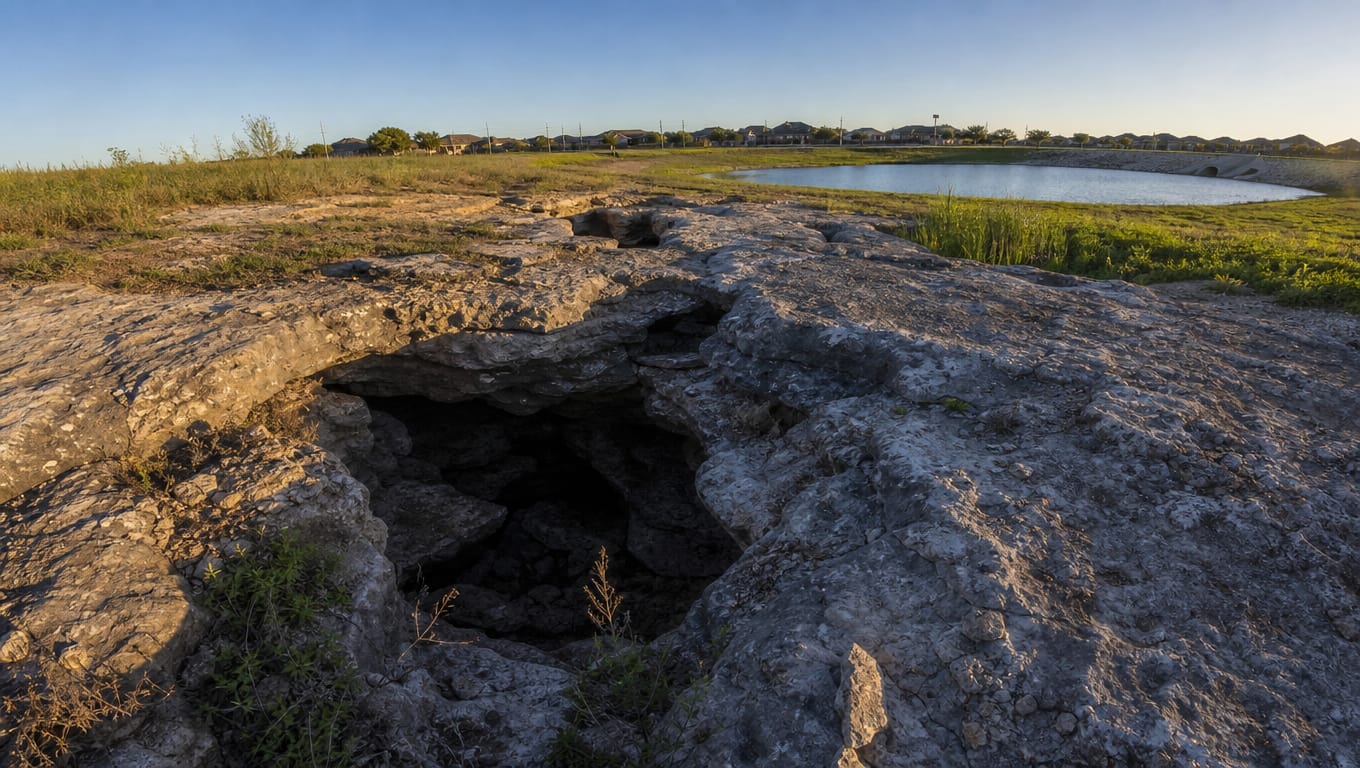
The logic is straightforward. The whole point of the Recharge Zone is that surface water enters the aquifer directly through caves, sinkholes, faults, and fractures. A basin designed to hold contaminated runoff and let it settle is, unlined, a very efficient delivery mechanism into the drinking water supply. The liner is what makes a treatment basin a treatment basin rather than an injection point.
Whether your specific basin requires a liner is a design determination for your engineer of record, made through the Water Pollution Abatement Plan. See Edwards Aquifer Protection Plans: WPAP and CZP basics.
The clay liner specification
RG-348 requires clay liners to meet the specifications in Table 3-6 and to have a minimum thickness of 12 inches.
| Property | Test method | Specification |
|---|---|---|
| Permeability | ASTM D-2434 | 1 x 10⁻⁶ cm/sec |
| Plasticity index of clay | ASTM D-423 and D-424 | Not less than 15 |
| Liquid limit of clay | ASTM D-2216 | Not less than 30 |
| Clay particles passing | ASTM D-422 | Not less than 30% |
| Clay compaction | ASTM D-2216 | 95% of Standard Proctor density |
| Minimum thickness | 12 inches |
A few practical notes from building these.
Permeability is the governing criterion. The other properties exist to get you there. A material can meet the plasticity and gradation numbers and still fail permeability if it is placed badly, and compaction is usually the reason.
95% Standard Proctor is not a formality. Under-compacted clay is the most common cause of a liner failing acceptance testing. Moisture conditioning matters as much as the roller passes, and in a Bexar County summer that means placing wetter than feels natural.
Test during placement, not after. Discovering a permeability failure after the basin is graded and the outlet structure is in means excavating work you have already paid for.
The geomembrane alternative
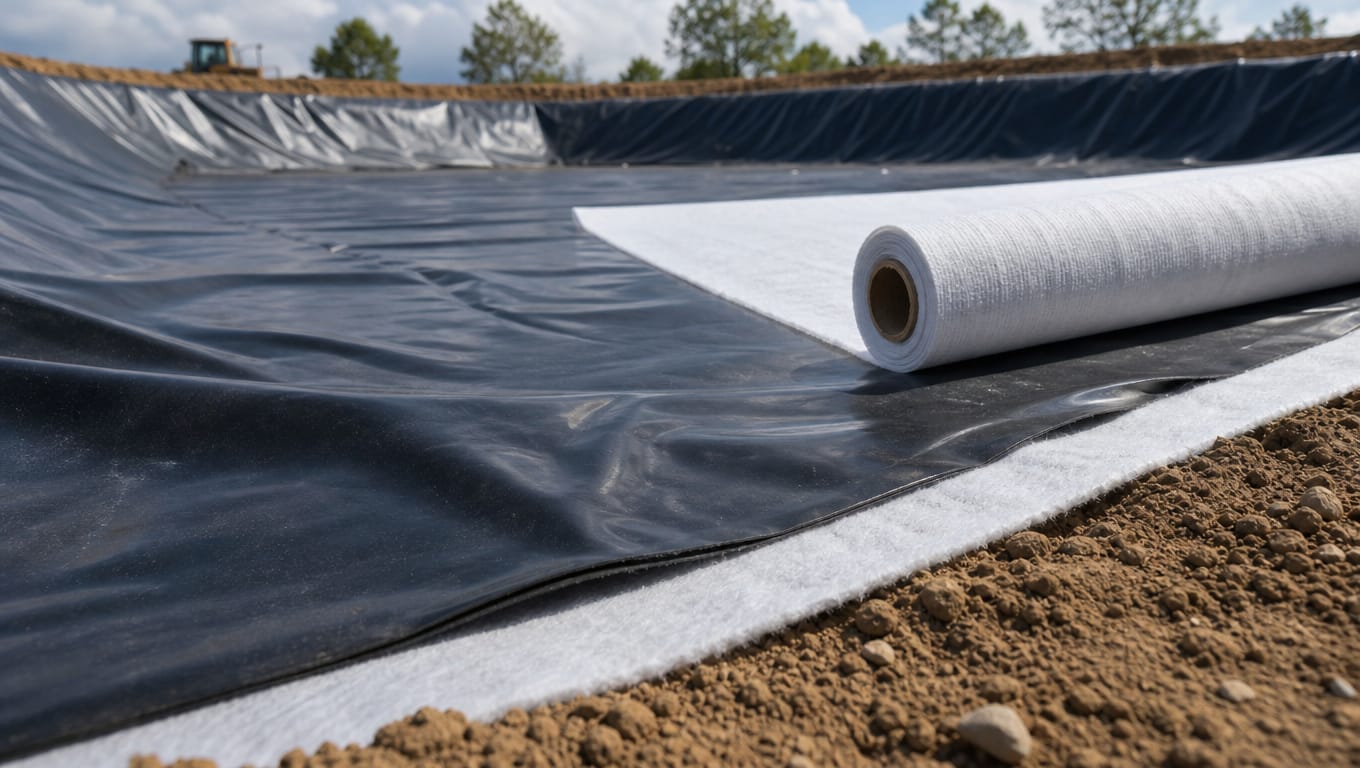
Where clay is impractical, RG-348 permits a geomembrane, with its own requirements:
- Minimum thickness of 30 mils
- Ultraviolet resistant
- Geotextile fabric on both the top and bottom of the membrane for puncture protection
- Covered with a minimum of 6 inches of compacted topsoil
- Topsoil stabilized with appropriate vegetation
The geotextile requirement on both faces is worth emphasizing because it gets value-engineered out. It is puncture protection, and a punctured geomembrane over the Recharge Zone is worse than no liner at all, because everyone believes the basin is lined.
The 6 inches of topsoil and the vegetative stabilization are not landscaping. They protect the membrane from UV exposure and mechanical damage, and they are part of the specification.
RG-348 also sets specifications for the geotextile fabric itself, in Table 3-7. If you are specifying material, work from the manual rather than from a vendor cut sheet.
Concrete
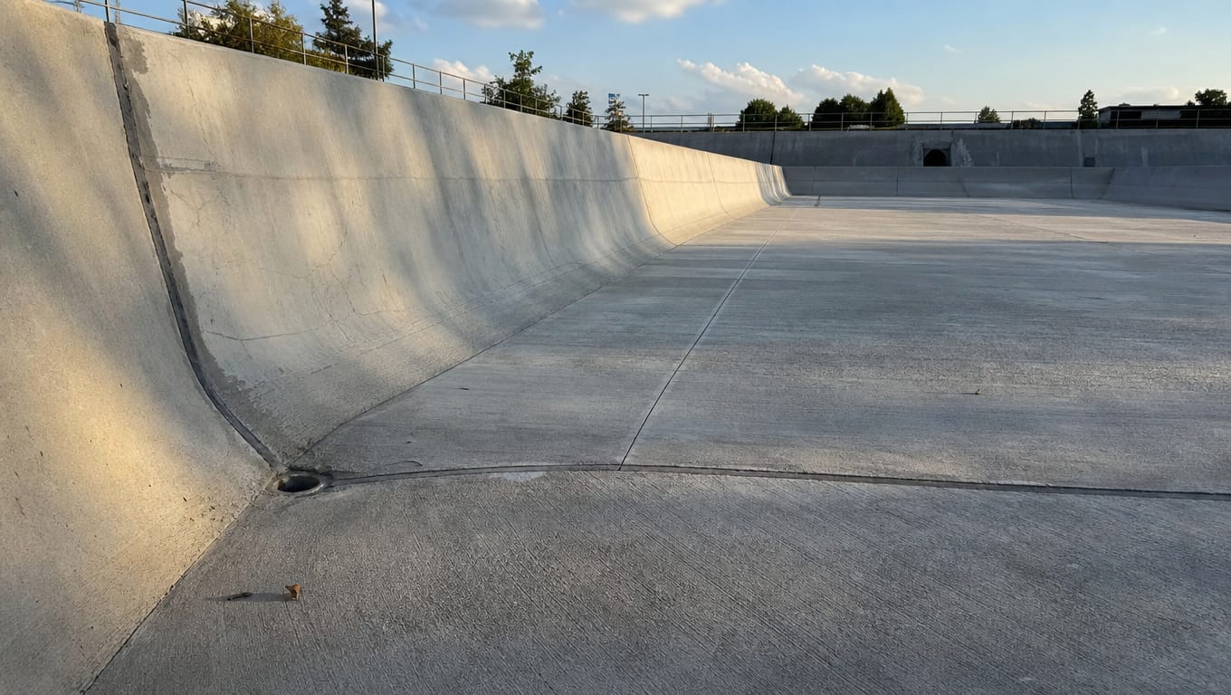
RG-348 lists concrete alongside clay and geomembrane as an acceptable impermeable liner.
In practice concrete shows up on smaller basins, on sand filter structures, and where maintenance access argues for a hard bottom. It is more expensive up front and considerably easier to inspect and maintain, and on a basin that will be cleaned out regularly it often wins on lifetime cost.
Its failure mode is different too. Clay fails by cracking and permeability loss. Concrete fails at joints, at penetrations, and through spalling, which in this region tends to follow winter freeze events.
Where this specification comes from
A point of precision that matters in this market.
Table 3-6 in RG-348 is credited to City of Austin 2004 criteria. TCEQ adopted the Austin clay liner specification into its own Edwards Aquifer guidance, and because TCEQ published it, it applies here. That adoption is legitimate and the specification is the one to build to.
We flag it because Austin criteria circulate improperly in this market in other contexts. Austin and San Antonio both regulate development over the Edwards Aquifer, their documents look similar, and figures migrate between them. Water quality volume and drawdown numbers in particular get lifted from Austin's criteria and applied to San Antonio projects where they do not belong.
The distinction is simple. If TCEQ adopted it into RG-348, as with this liner table, it applies. If someone hands you an Austin number that TCEQ and the City of San Antonio never adopted, it does not. Ask which document it came from.
RG-348 has also been revised and amended over time, with errata and addenda, and at least one addendum has been the subject of subsequent review. Before you specify from a copy, check TCEQ's Edwards Aquifer rules and technical guidance page for the current version rather than working from a PDF that has been sitting on a server.
Why liners fail in Bexar County
The manual gives you the specification. Field experience gives you the failure modes, and here they are specific to this region.
Shrink-swell cracking. Bexar County clay shrinks in drought and swells when wet. A clay liner that has been through a dry summer can develop tension cracks that compromise permeability, then close again when it rains, which makes the problem intermittent and hard to catch. A basin that holds water in spring and leaks in September is telling you something.
Penetrations at inlet and outlet structures. The most common failure point on any liner, clay or membrane. Water finds the interface between the liner and the concrete, and the seal at that junction does the hardest work in the whole basin.
Root intrusion. The wrong vegetation on a lined basin sends roots through the liner. Grasses are appropriate. Woody species are not, and volunteer mesquite and hackberry in a basin floor are a liner problem in progress rather than a mowing problem.
Differential settlement. Inadequate subgrade preparation shows up years later as low spots, cracking, and lost freeboard.
Damage during maintenance. A sediment removal crew with a track hoe and no drawing of the liner depth can remove the liner along with the sediment. This is more common than anyone admits, and it is why sediment removal on a lined basin is a different job from sediment removal on an unlined one.
Freeze damage on concrete. Spalling at joints and structures after a hard freeze, which this region gets often enough to matter.
Repairing an existing liner
Repair on an in-service basin is a different problem from installing a new liner, and there is essentially no published guidance for it.
The sequence that works:
- Establish what you actually have. Pull the as-builts and the approved WPAP. Clay, membrane, and concrete are repaired differently, and guessing wrong is expensive.
- Find the failure. Drawdown behavior, wet spots on the exterior embankment, vegetation patterns, and observation of the basin through a wet-dry cycle all tell you something.
- Dewater and expose. Legal disposal of removed water and sediment is part of the job.
- Prepare the subgrade properly, including proof rolling, before replacing material.
- Rebuild to the original specification, which means the permeability and compaction targets above, tested rather than assumed.
- Rebuild the penetrations deliberately, since that is where it failed last time.
- Document and file. Photo documentation, as-built revisions, and notification to the reviewing authority where the approved plan is affected.
That last step is the one people skip. A repaired basin whose as-builts still show the original condition creates a problem for the next owner and for the next inspection.
What an inspector checks
For a lined basin over the Recharge Zone, expect attention to:
- Whether the basin draws down as designed, since a liner failure often shows up as unexpected infiltration
- Cracking on the basin floor and side slopes
- The condition of inlet and outlet penetrations
- Vegetation type, particularly woody growth
- Evidence of maintenance damage
- Whether documentation matches the approved plan
- On concrete, joint condition and spalling
Remember that over the Recharge Zone within COSA jurisdiction, SAWS inspects quarterly to verify compliance with the approved WPAP. That is an ongoing obligation on the owner, not a construction-phase event.
Liner repair and basin restoration
We repair clay and geomembrane liners, rebuild penetrations at inlet and outlet structures, and restore basins to their original design specification, closed out with photo documentation, as-built revisions, and filing with the municipality.
We are not your design engineer. Liner design belongs to the engineer of record and we work to the approved plan. What we do is build it correctly, find out why the existing one failed, and put it back to specification.
If your basin is holding water it should not, or drawing down faster than it should, a site walk will tell you which. Free, with a written scope and fixed price typically inside 48 hours.
Request a quote or call (210) 776-6515. See detention and retention basin repair, BMP maintenance and repair, or the full local picture in San Antonio, Bexar County, and Edwards Aquifer stormwater rules.
Sources
Common questions
- Does my basin need a liner over the Recharge Zone?
- Water quality basins over the Recharge Zone generally require impermeable liners under RG-348, including retention, extended detention, sand filters, wet ponds, and constructed wetlands. Your engineer of record determines it through the WPAP.
- What is the clay liner permeability requirement?
- 1 x 10⁻⁶ cm/sec, tested to ASTM D-2434, with a minimum thickness of 12 inches and compaction to 95% of Standard Proctor density.
- Can I use a geomembrane instead of clay?
- Yes. Minimum 30 mils, UV resistant, with geotextile fabric top and bottom and at least 6 inches of compacted topsoil stabilized with vegetation.
- Why does the specification reference City of Austin criteria?
- TCEQ adopted the Austin clay liner table into RG-348. Because TCEQ published it, it applies. That is different from Austin figures TCEQ never adopted, which do not.
- My basin is losing water. Is the liner failed?
- Possibly. Unexpected drawdown is a common symptom, but it can also be an outlet issue. Establish what liner you have and observe the basin through a wet-dry cycle before assuming.
- Can a sediment removal crew damage the liner?
- Yes, routinely. Sediment removal on a lined basin requires knowing the liner depth and type before the first bucket.
The work behind this article
- Detention Pond and Basin Repair
Bathymetric survey, sediment removal, regrading, and outlet rebuild for detention ponds and retention basins that have silted in, washed out, or stopped draining the way the design drawing said they would.
- Stormwater Filter Service
Confined-space crews, OEM-spec cartridges in the truck, waste manifested off site. Your treatment vault back to design flow in a single visit.
- Stormwater Inspection Services
CISEC and CESSWI inspectors, on your site every seven days while the job is live and on your MS4's schedule once it is not. One inspector, one tablet, forty checkpoints, and the report before the truck leaves the property.
Need help with stormwater compliance on a San Antonio property? We do site walks at no charge.
Request a fixed-price quoteMore field notes from the watershed.
 Compliance · 11 min
San Antonio, Bexar County, and Edwards Aquifer Stormwater Rules
A San Antonio construction site can sit under five separate stormwater authorities at once: TCEQ for the state permit, TCEQ's Edwards Aquifer Protection Program for the aquifer overlay, SAWS and the City of San Antonio inside city limits, and Bexar County Public Works in the unincorporated area
 Field guide · 7 min
Who Regulates Stormwater in San Antonio? A Jurisdiction Map
Seven bodies touch stormwater in the San Antonio metro. TCEQ runs the state construction permit and the Edwards Aquifer overlay. SAWS, the City of San Antonio, and TxDOT are MS4 co-permittees. Bexar County Public Works regulates post-construction in the unincorporated area. The San Antonio River
Get a stormwater
compliance quote.
Free site walk, written scope of work, fixed-price quote. Usually back to you within 48 hours.