
SWPPP Site Maps and BMP Sequencing
A compliant SWPPP site map shows your actual drainage areas, flow directions, discharge points, receiving waters, and the location of every control, tied to a construction sequence that describes when each control goes in and comes out. A map that does not change as the site changes is the most
Published August 31, 2026. Last reviewed August 31, 2026. Technical review: Jim Price, CISEC, CESSWI. Founder, Stormwater Compliant LLC.
A compliant SWPPP site map shows your actual drainage areas, flow directions, discharge points, receiving waters, and the location of every control, tied to a construction sequence that describes when each control goes in and comes out. A map that does not change as the site changes is the most common reason a plan fails inspection.
"Site-specific" is the phrase everyone selling a SWPPP uses. Here is what it actually has to mean.
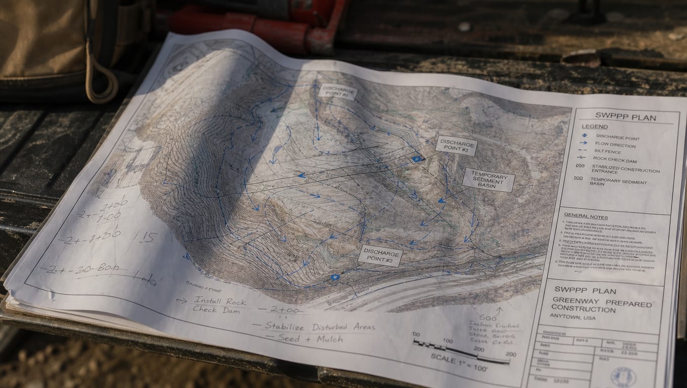
What "site-specific" actually means
It is a testable claim, not an adjective. Open the plan and check three things:
- Does the site map show your topography and drainage? Real contours, real flow arrows, real discharge points. Not a generic rectangle with a silt fence drawn around it.
- Does the construction sequence match your actual schedule? The phases you will build, in the order you will build them, with controls tied to each.
- Do the specified controls match what the site needs? Slope, soil, receiving water, and the disturbance you are actually creating.
A plan that fails any of those is a template with your address typed at the top. Templates are not illegal. They are inadequate, and the inadequacy shows up at inspection rather than at purchase, which is what makes them feel like a bargain right up until they are not.
Templates fail on the site map first, because a map is the one thing that cannot be genericized. Everything else in a SWPPP can be written in reasonably standard language. The map cannot.
Anatomy of a compliant site map
Per Part III, Section F of the 2023 Construction General Permit, and from what inspectors actually open the plan to check:
The site itself
- Property boundaries and the limits of disturbance
- Total site acreage and total disturbed acreage
- Existing topography with contours
- Areas of soil disturbance, phased if the project is phased
The water
- Drainage area boundaries
- Flow direction arrows, pre- and post-development where they differ
- All discharge points and outfalls
- Receiving waters, named
- Any surface waters, wetlands, or drainage features on or adjacent to the site
- Where the site connects to the MS4
The controls
- Every erosion and sediment control, located
- Perimeter controls
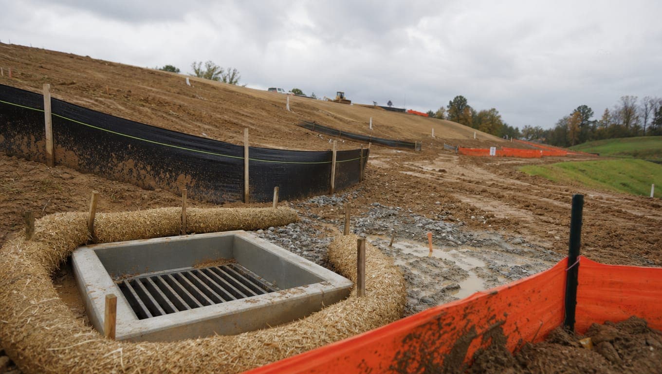
- Inlet protection at every inlet receiving site runoff
- Stabilized construction exits at every access point
- Sediment traps, basins, and diversions
- Areas of temporary and permanent stabilization
The operational areas
- Concrete washout locations
- Material and fuel storage
- Waste collection and portable toilets
- Vehicle and equipment staging
- Stockpiles, with their own controls
The housekeeping
- North arrow, scale, legend
- Revision date
That last line does more work than it looks like. A site map with no revision history on a project that has been running eight months tells the inspector the plan has not been maintained before they read a single control.
The construction sequence is the other half
The map is a snapshot. The sequence is the movie, and the permit requires a description of the sequence of major construction activities.
The sequence has to answer, for each phase: what work happens, what gets disturbed, which controls must already be in place before that work starts, which controls get installed during it, and which come out.
The reason this matters is directional. Controls that protect a site during clearing are not the controls that protect it during vertical construction. A plan that specifies one static set of controls for the life of the project is either over-controlling early or under-controlling late, and usually both.
One site, four phases
Take a generic 10-acre commercial site. Here is how the controls actually move.
Phase 1: Clearing and grubbing
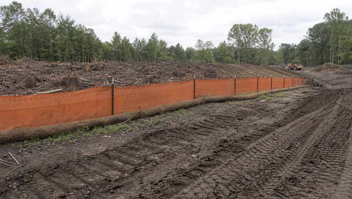
Highest erosion risk per acre disturbed, and the phase most often under-controlled because "we are just clearing."
| Control | Status |
|---|---|
| Perimeter silt fence or wattles | Installed before clearing starts |
| Stabilized construction exit | Installed before any equipment enters |
| Inlet protection on receiving inlets | Installed before clearing |
| Tree and vegetation preservation limits | Flagged |
| Concrete washout | Not yet needed |
The sequencing rule: perimeter controls and the construction exit precede disturbance. Installing them after clearing means the first storm already carried sediment offsite.
Phase 2: Mass grading
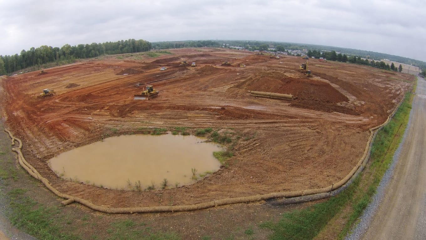
Maximum disturbed area, maximum sediment generation.
| Control | Status |
|---|---|
| Perimeter controls | Maintained, extended as disturbance grows |
| Sediment basin or trap | Installed and functional |
| Diversion berms and swales | Installed to route clean water around disturbance |
| Slope protection on cut and fill | Installed as slopes are created |
| Dust control | Active |
| Stockpile controls | Installed with each stockpile |
| Temporary stabilization on dormant areas | Initiated within one work day of activity ceasing |
Phase 2 is where the stabilization deadline starts producing findings, because areas finish grading and go quiet while the crew moves on. See stabilization deadlines contractors get wrong.
Phase 3: Utilities and paving
Disturbance narrows but the pollutant profile changes.
| Control | Status |
|---|---|
| Trench spoil controls | Installed with each open trench |
| Dewatering controls | Required for any trench dewatering |
| Concrete washout | Installed and maintained |
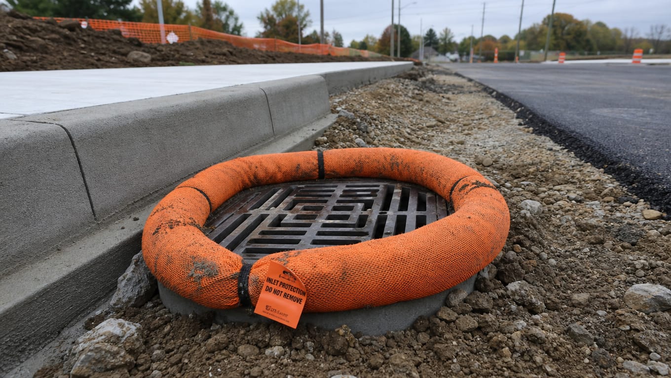
| Inlet protection on new inlets | Installed as each inlet is built |
| Perimeter controls | Reduced where areas have stabilized |
| Sediment basin | Still functional, sediment removed as it accumulates |
New inlets are a routine finding. A storm drain built Tuesday and left unprotected until someone updates the plan is an unprotected conveyance straight to the receiving water.
Phase 4: Vertical construction and stabilization
| Control | Status |
|---|---|
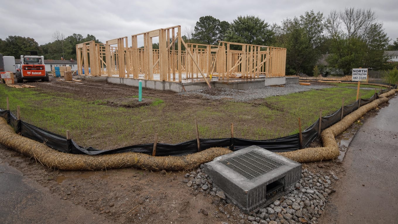
| Inlet protection | Maintained, and it is now the primary defense |
| Concrete washout | Maintained through the pour schedule |
| Waste and material controls | Active |
| Permanent stabilization | Established progressively |
| Temporary controls | Removed only as permanent stabilization takes over |
| Sediment basin | Converted or removed per design |
The failure here is removing temporary controls too early because the site "looks finished." Landscaping that has not established is not stabilization.
When the plan has to change
The SWP3 is a living document, and the permit puts clocks on keeping it current.
Update within seven calendar days when existing BMPs are modified or new ones are added.
Record stabilization initiation dates as areas go dormant.
Amend the plan when the construction sequence changes, when disturbed acreage changes materially, when operators change, or when an inspection finds a control that is not working and a different approach is needed.
Keep the amendments with the plan. A binder showing eleven dated revisions across a year-long project is evidence of a managed site. A pristine binder is evidence of the opposite, and inspectors read it that way.
Why installing something better is still a violation
This one is counterintuitive and it catches good contractors.
If the plan specifies silt fence and your crew installed wattles, that is a violation. Even if the wattles perform better. Even if the site is cleaner than the plan would have produced.
The reason is that the permit requires you to implement the plan. The plan is the enforceable document, and a site that does not match its own plan cannot be evaluated against anything.
The fix is not to install what the plan says regardless of judgment. The fix is to amend the plan. You are allowed to change your approach. You are required to write it down. Field judgment plus a documented amendment is compliance. Field judgment alone is a finding.
How to evaluate the plan you already have
Open your SWP3 and work through this. It takes ten minutes.
The site map
- Are the property boundaries and limits of disturbance your actual boundaries?
- Are there real contours, or a flat outline?
- Are flow direction arrows shown, and do they match where water actually goes?
- Are your discharge points marked, and is the receiving water named?
- Is every existing inlet shown with protection?
- Are concrete washout and material storage located?
- Is there a revision date, and has it ever been revised?
The sequence
- Does it describe your phases in your order?
- Does each phase list which controls go in before work starts?
- Does it say when temporary controls come out?
The controls
- Does every control on the map exist on the ground, in that location?
- Does every control on the ground appear on the map?
- Do the specified controls suit your slopes and soils?
The records
- Are inspection reports filed with the plan?
- Do findings have documented corrective actions with dates?
- Are stabilization initiation dates recorded?
If you failed more than three of those, the plan will not hold up. That is a fixable problem, and it is much cheaper to fix before an inspection than after.
Send us the civil drawings
We write site-specific plans, which in practice means we walk the site, mark the flow paths, photograph the existing drainage, and build the sequence around your actual schedule. You get a hard-copy field binder for the trailer, a digital copy, and a superintendent walkthrough so the person responsible for the plan has actually seen it.
If you already have a plan and it failed the checklist above, we will review it and tell you what it would take to make it defensible.
Free site walk, written scope, fixed price, typically inside 48 hours.
Request a quote or call (210) 776-6515. See our SWPPP services, or the full permit walkthrough in our field guide to the TCEQ Construction General Permit.
Sources
Common questions
- What has to be on a SWPPP site map?
- Property boundaries and limits of disturbance, topography, drainage areas and flow directions, discharge points and receiving waters, every control including inlet protection and stabilized exits, operational areas like concrete washout and material storage, and a revision date.
- Can I use a SWPPP template?
- There is no rule against starting from a template. But a compliant plan requires a real site map and a sequence matching your schedule, and neither of those can be pre-written. Templates fail on the map.
- How often does the site map need updating?
- Whenever the site changes materially, and within seven calendar days when BMPs are modified or added.
- My controls work better than the plan specifies. Is that a problem?
- Yes, until you amend the plan. Performance is not the test. Implementing the plan is.
- Who has to prepare the site map?
- The permit does not require a licensed professional for the SWP3 itself. Whether the person preparing it has stood on the site is the question that actually determines quality.
- Does the plan get filed with TCEQ?
- No. The SWP3 stays on site. Only the NOI is filed, and only for large construction.
The work behind this article
- Stormwater Pollution Prevention Plan (SWPPP)
A San Antonio SWPPP company that writes the plan, files the NOI, and walks the binder with your superintendent. Site-specific to your grading plan, written to TXR150000, not a template with somebody else's logo taken off.
- Stormwater Basin and BMP Maintenance
A Texas stormwater maintenance company that runs your basins and ponds on a calendar instead of on emergencies. Mowing, vegetation, sediment, trash racks, and inlets on the scheduled visit, and crews on site within 72 hours when a control is failing between them.
- Stormwater Inspection Services
CISEC and CESSWI inspectors, on your site every seven days while the job is live and on your MS4's schedule once it is not. One inspector, one tablet, forty checkpoints, and the report before the truck leaves the property.
Need help with stormwater compliance on a San Antonio property? We do site walks at no charge.
Request a fixed-price quoteMore field notes from the watershed.
 Compliance · 14 min
Texas SWPPP Requirements: A Field Guide to the TCEQ Construction General Permit
If your project will disturb one acre or more of soil in Texas, you need coverage under the TCEQ Construction General Permit, TXR150000, and a Stormwater Pollution Prevention Plan in place before construction begins. Sites of five acres or more must also file a Notice of Intent. Smaller sites
 Field guide · 8 min
The Most Common SWPPP Violations on San Antonio Job Sites
The violations we write most often are not exotic. They cluster in two groups: documentation that was never completed, and controls that were installed incorrectly rather than not installed at all. Roughly half of what gets cited on a well-run site is paperwork, which is the part contractors
Get a stormwater
compliance quote.
Free site walk, written scope of work, fixed-price quote. Usually back to you within 48 hours.